.gif)


 uh31.dpri.kyoto-u.ac.jp
.gif)
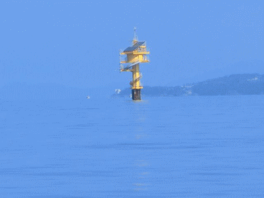
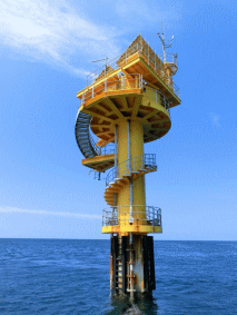
Tanabe-Nakashima Oceanographic Observation Tower
There is a Oceanographic Observation Tower; Tanabe-Nakashima Oceanographic Observation Tower, in the bay mouth of Tanabe Bay, Wakayama prefecture. The tower was built for comprehensive observation station of weather and oceanographic phenomenon in near shore areas. Tanabe bay is opened to west and the width of bay mouth is around 4.0km, the bay area is 17.95 km2 and the topography of ocean floor is almost flat, and the mean depth of the bay is approximately 30 meter. There is an underwater mountain rising above the ocean floor at the center of bay mouth, which is called Nakashima, and the observation tower was built on the top of underwater mountain in 1993.
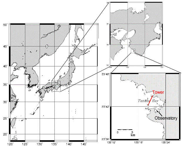
※Location of Tower: lat.33°42′32″N, lon.135°19′58″E (World Geodetic System)
_En.gif)
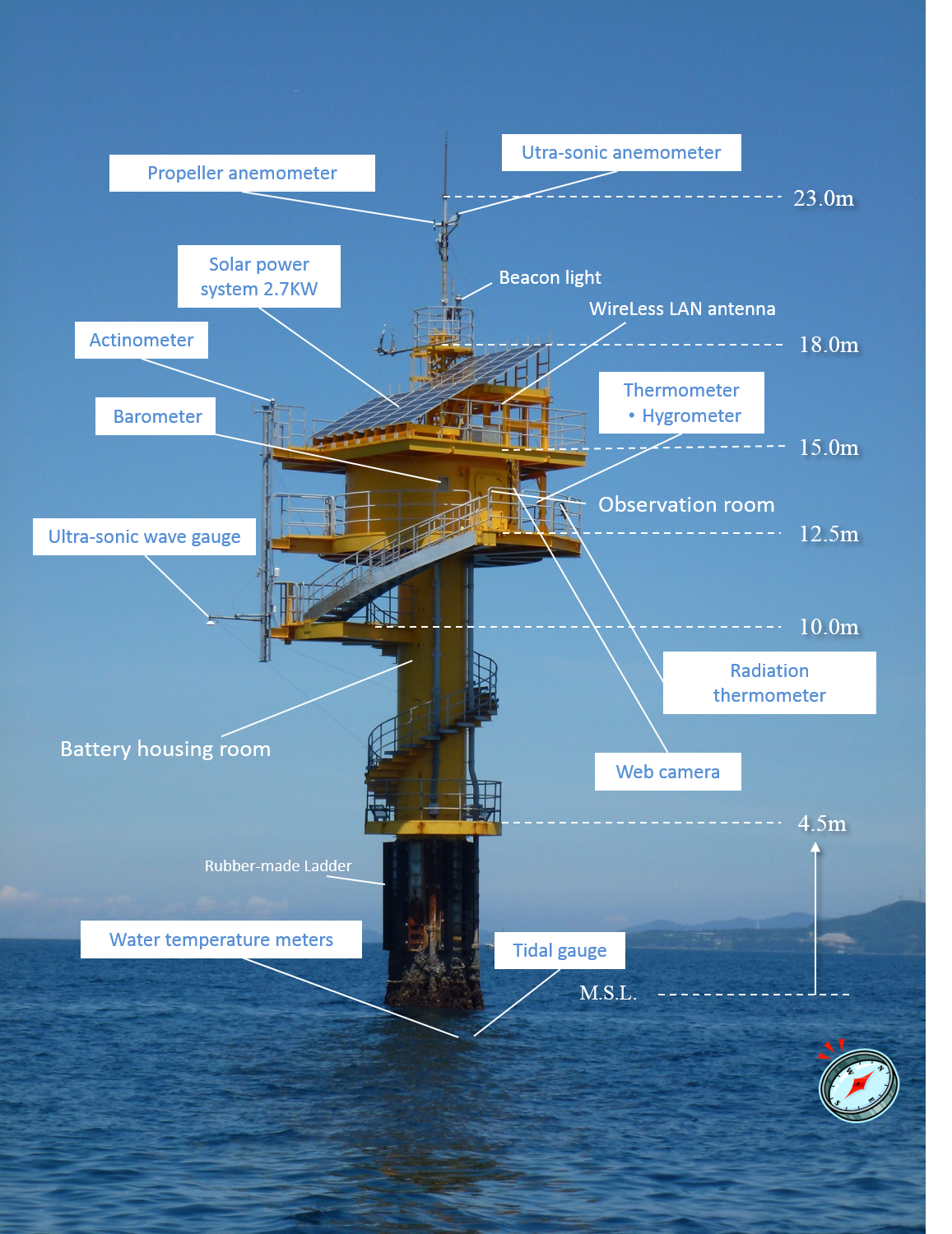
Measurement Items
Several measuring instruments, e.g. anemometer, pyranometer, thermometer, hygrometer, barometer, wave gauge and water thermometer, are installed on the tower in order to implement continuous observation in the sea ares.
Additionally, webcam is installed at the tower and the photographing images and those observation data are collected to data storage system. And then those collected data are transmitted periodically to main building of observatory through wireless LAN system. The transmitted data are stored and analysed automatically on the server.
※Click the image to see the enlarged image.
The latest observation data are disclosed to everyone on the website of observatory, and the data have been accumulated in the forms of daily report and monthly report, which are including mean and maximum value, after analysis and confirmation process on the server.
The observed data have been provided to the activity of cooperative research, Japan Coast Guard, Japan Oceanographic Data Center, Nanki-Shirahama Airport and local governments as occasion calls.
Observation Boat; Kaisho 「海象」
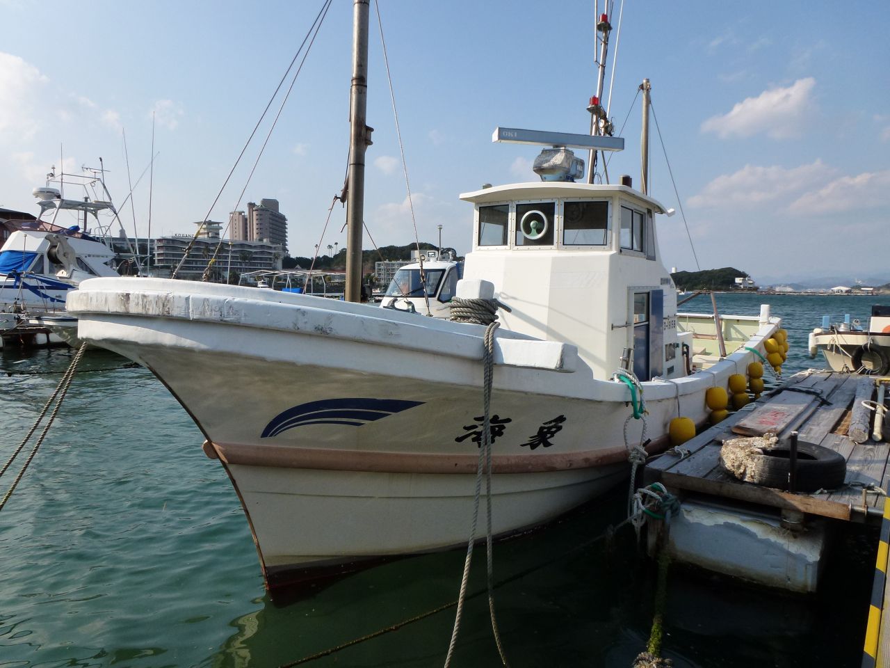
Owner Kyoto University
Intended purpose Research ship
Registered number 252-12909
Type of boat Bracket type
Material FRP
Home port Shirahama Port
Ship hull
Total length 11.66m Registered length 9.25m
Total width 3.20m Registered width 2.41m
Deepness 1.26m Registered depth 0.63m
Gross tonnage 3.4ton
Engine YAMAHA MD730KUH 340Ps
Speed cruising;18 knots Max.;23 knots
Capacity 12 people(crew 1, passenger 11 people)
Nautical instruments
GPS
Ultrasonic sounding machine
General tools
derrick crane (hand‐powered)(500kg)
Oil pressure capstan
Electric winch4φ200M(200kg)
AC generator AC100V 3KW
Stabilized power supply AC100V. 500W
Observation Systems / Measuring Instruments
Available observational equipments
| Observation | Profiling | Manufacture | Notes |
|---|---|---|---|
| ADCP | 0~20m | RD Instruments | ADCP frequency 1200Hz |
| Electromagnetic current meter | ALEC Electronics & IOTechnic | Current speed/(Temperature)/(Salinity) | |
| STD | 0~100m(cable length:50m) | AAQ1183-H | Temperature/Salinity/Depth/DO/Turbidity/Chlorophyll/pH |
| Ultrasonic wave gauge | FS 15m | KAIJO SONIC | Wave speed/Wave height |
| Propeller type anemometer | 0.4~90m/s | W855-Z1(KOMATSU) | Wind speed/Wind direction<2D> |
| Ultrasonic anemometer | 0~60m/s | SAT-550(SONIC) | Wind speed/Wind direction<3D> |
| Ultrasonic Weather Station | Airmar(WICS) | Wind speed/Wind direction<2D>/Barometric pressure/Air temperature/Humidity | |
| Rain gauge | RT-5(IKEDA KEIKI) | Tipping bucket type, Dia. of receiver:200mm, A tilt of bucket:0.5mm |