Research
Research topics
- Sediment production due to freeze-thaw action on bare slopes, and field observation for debris flow initiation
- Study on triggering mechanism of snowmelt type mudflow
- Development of measurement method for bedload discharge
- Prediction of shallow landslides
- Rainfall-runoff processes caused by volcanic eruptions
- Flash flood in alpine watersheds
- Application of TDR to bedload monitoring
- Sediment flushing experiment
- Large scale experiment of landslide dam overtopping and dam break
Sediment production due to freeze-thaw action on bare slopes, and field observation for debris flow initiation
Sediment production, destruction of weathered bedrock, due to freeze and thaw action is commonly observed on bare slopes in various area during winter season. This type of the sediment production depends on climate, geology, topography of the area, and represents a potential of sediment supply to the watershed in long-term perspective. We have conducted a field observation of the sediment production due to freeze-thaw action, developed a model of freeze-thaw cycles based on thermal conductivity analysis, and simulated total sediment production in a watershed.
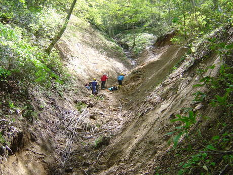
The deposition of sediment produced from bare slope is one of the major sources of debris flow triggered by heavy rainfall. Although it is assumed that the sediment deposition always saturated by pore water at the debris flow occurrence in previous debris flow researches, however unsaturated conditions of the sediment deposition are recently pointed out according to several field observations. We have conducted a field observation for debris flow initiation measuring the pore water pressure in sediment deposition at the Hiru dani stream.
Click here for references
- Tsutsumi, D., Fujita, M. (2016): Field observations, experiments, and modeling of sediment production from freeze and thaw action on a bare, weathered granite slope in a temperate region of Japan, Geomorphology, 267, 37-47.
- 泉山寛明,堤大三,藤田正治(2015):地質を考慮した風化基岩における凍結融解による土砂生産量の推定方法,砂防学会誌,68(5),10-20.
- 堤大三,藤田正治,竹門康弘,角哲也,泉山寛明(2014):木津川流域の土砂生産ポテンシャルの推定,砂防学会誌,66(5),13-22.
- 速見智,里深好文,藤本将光,堤大三(2014):山地源頭部における渓床堆積物中の水分動態および土砂流出に関する研究,第7回土砂災害に関するシンポジウム論文集,211-216.
- 速見智,里深好文(2013):山地源頭部における渓岸堆積物の水分動態と土砂移動の観測,土木学会論文集B1(水工学),69,I_943-I_948.
- Izumiyama, H., Tsutsumi, D., Fujita, M. (2012): Effect of Freeze-Thaw Action on Porosity Change and Destruction of Weathered Bedrock in Different Lithology and Development of Destruction Model, International Journal of Erosion Control Engineering, 5(1), 103-112.
- 泉山寛明,堤大三,藤田正治(2012):間隙構造の変化を考慮した風化基岩の凍結融解時における熱伝導と水分移動の解析,土木学会論文集B1(水工学),68(4),I_529-I_534.
- 泉山寛明,堤大三,藤田正治(2011):裸地斜面の凍結融解強度に積雪および地形特性が与える影響,水工学論文集,55,715-720.
- 堤大三,藤田正治,泉山寛明(2009):気温上昇による土砂生産に対する凍結融解の影響変化予測,水工学論文集,53,649-654.
- 泉山寛明,堤大三,手島宏之,藤田正治(2009):地表面熱収支を考慮した裸地斜面における凍結融解シミュレーション,水工学論文集,53,643-648.
- 水谷太郎,里深好文,堤大三,水山高久(2008):急勾配渓床堆積物中の水分移動,砂防学会誌,61(3),27-30.
- 堤大三,藤田正治,伊藤元洋,手島宏之,澤田豊明,小杉賢一朗,水山高久(2007):凍結融解による土砂生産に関する基礎的研究―田上山地裸地斜面における現地観測と数値シミュレーション―,砂防学会誌,59(6),3-13.
- 堤大三,藤田正治,澤田豊明,伊藤元洋,手島宏之(2006):滋賀県南部田上山地における凍結融解と土砂生産に関する観測,京都大学防災研究所年報,49,567-573.
- Tsutsumi, D., Fujita, M., Teshima, H. (2006): Field Observation and Numerical Simulation for Sediment Yield due to Freeze and Thaw Process, The 6th Japan-Taiwan Joint Seminar on Natural Hazard Mitigation
Study on triggering mechanism of snowmelt type mudflow
By falling heated volcanic products on snow cover, huge amount of snowmelt water possibly triggers a mudflow disaster. We call this "snowmelt type mudflow", and consider a very risky hazard in terms of the disaster mitigation. To mitigate the risk of this snowmelt type mudflow, it is necessary to understand the mechanism of snowmelt and mudflow initiation, improve the numerical simulation method for mudflow behavior based on the mechanism. We have conducted several snowmelt experiment triggering mudflow, and developed a snowmelt and melting water infiltration model. We also conduct a cooperative research with PWRI, observing changing water content in snow, snow density.
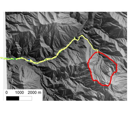
Because of few cases of mud-flow triggered by snowmelt, their processes are still little understood. However, improvement of numerical simulation of the mud-flow requires accurate estimations of volume and timing of the mud-flow as initial conditions. We attempt to develop a model of snowmelt processes by hot volcanic materials. We also compose a comprehensive model of mud-flow throughout its generation to runoff to predict affected areas and timings of mud-flow under various conditions of snows and eruption.
Click here for references
- 山口翔大,宮田秀介,堤大三,村重慧輝,藤田正治(2019):数値解析による積雪条件の異なる融雪型火山泥流予測,砂防学会誌,71(6),3-13.
- 泉山寛明,堤大三,野池耕平,藤村直樹,水野秀明(2016):蒸発熱を考慮した火砕物による融雪量推定に関する研究,砂防学会誌,69(4),10-15.
- 村重慧輝,堤大三,宮田秀介,藤田正治,酒井英男,上石勲(2015):火山泥流発生機構解明のための高温砂礫による融雪に関する実験的研究,砂防学会誌,67(6),3-10.
- 宮田秀介,堤大三,村重慧輝,宮本邦明,藤田正治(2014):泥流発生過程を考慮した融雪型火山泥流の予測,土木学会論文集B1(水工学),70(4),I_949-I_954.
- Tsutsumi, D, Murashige, K, Fujita, M, Miyata, S (2014): Experimental Study on the Triggering Mechanism of Snowmelt-type Mudflow, The 5th International Workshop on Multimodal sedimet Disaster, 26-32.
- 上石勲,堤大三,宮田秀介,藤田正治,酒井英男(2014)融雪型火山泥流発生機構解明のための高熱岩石による融雪実験とモデル計算,第29回寒地技術シンポジウム,34-37.
Development of measurement method for bedload discharge
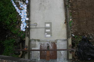
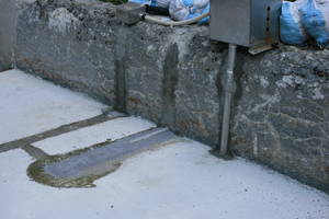
For integrated sediment control in a total river system and mitigation of sediment related disasters, actual measurement of sediment discharge is an essential work. Japanese pipe-hydrophones and Swiss plate geophones are recently practically used in Japan and European countries. Each equipments has its advantages and disadvantages for its structure and type of sensor. We cooperate with WSL in Switzerland to compare performance of these equipments, installing both pipe hydrophones and plate geophones at Ashiarai dani in Japan and at Erlenbach in Switzerland. We also installed a vertical type pipe hydrophone at Ashiarai dani to improve the bedload measurement. We also cooperate with Nippon Koei to develop a load cell type bedload measurement equipment.
Click here for references
- 東豊,堤大三,宮田秀介,藤田正治(2022):パルス法による山地河川における流砂量推定手法の高度化,砂防学会誌,74(5),3-13.
- Ito, T., Nagayama, T., Utsunomiya, R., Fujita, M., Tsutsumi, D., Miyata, S., Mizuyama, T. (2018): Development of new sensor systems for continuous bedload monitoring using a submerged load-cell system (SLS), Earth Surface Processes and Landforms, 43(8), 1689-1700.
- Ito, T., Nagayama, T., Utsunomiya, R., Fujita, M., Tsutsumi, D., Miyata, S., Mizuyama, T. (2017): Development of a bedload sensor for continuous measurement and its applicability, River Sedimentation - Proceedings of the 13th International Symposium on River Sedimentation, ISRS 2016, 239-245.
- 長谷川祐治,宮田秀介,今泉文寿,中谷加奈,堤 大三(2017):流砂の衝突回数を考慮したハイドロフォンデータによる解析手法の提案と現地への適用,土木学会論文集B1(水工学),73(4),I_523-I_528.
- Ito, T., Gotoh, K., Utsunomiya, R., Nonaka, M., Nagayama, T., Tsutsumi, D., Fujita, M., Miyata, S., Mizuyama, T. (2014): Experimental studies for monitoring of bedload using various sensors, Symposium Proceedings of INTERPRAEVENT2014 in the Pacific Rim, O-17, 1-10.
- Koshiba, T., Auel, C., Tsutsumi, D., Kantoush, S.A., Sumi, T. (2018): Application of an impact plate – Bedload transport measuring system for high-speed flows, International Journal of Sediment Research, 33(1), 35-46.
- Tsutsumi, D., Higashi, Y., Nonaka, N., Fujita, M. (2017): Bedload monitoring in a mountain stream method for improving the accuracy of the calibration relationship between acoustic pulses and bedload discharge, 2nd International workshop on sediment bypass tunnels.
- Goto, K., Itoh, T., Nagayama, T., Utsunomiya, R., Tsutsumi, D., Mizuyama, T. (2016): Development and installation of bedload monitoring systems with submerged load cells, Journal of Mountain Science, 13(2), 369-376.
- 小柴孝太,角哲也,堤大三(2016):プレート型振動センサを用いた掃流砂量計測手法に関する研究 ,土木学会論文集B1(水工学),72(4),I_925-I_930.
- 谷寧人,堤大三,水山高久(2012):流砂観測に基づく土砂移動特性の評価及び土砂供給減の推定,砂防学会誌,65(3),21-28.
- Mizuyama, T., Hirasawa, R., Kosugi, K., Tsutsumi, D., Nonaka, M. (2011): Sediment monitoring with a hydrophone in mountain torrents, International Journal of Erosion Control Engineering, 4(2), 43-47.
Prediction of shallow landslides
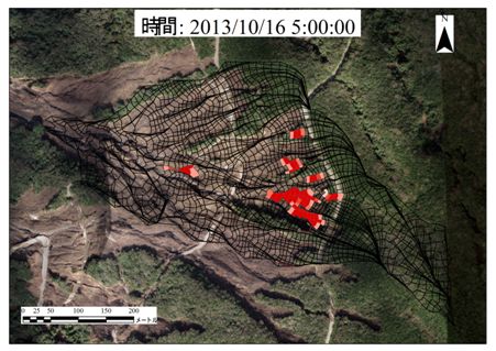
Shallow landslide area tend to widespread recently (surrounding area of Mt. Aso, 2012; Izu Oshima, 2013; Hiroshima, 2014), therefore it is difficult to simulate by a detailed model combining a saturate-unsaturate rainwater infiltration analysis and a slope stability analysis. On the other hand, conventional distributed model dividing a watershed by rectangular mesh for simulating landslide risk cannot predict accurate occurrence timing and amount of collapsed sediment. We are developing a new simulation method employing Topotubes for dividing the watershed and slope stability analysis with a critical slip surface method to improve the accuracy of the prediction and adaptability of the model to wider area.
Click here for references
- 堤大三(2020):土層内の浸透流解析にパイプ等による選択流を組込んだモデル,地下水学会誌,62(3),363-382.
- 山野井一輝,堤大三,藤田正治(2020):ストリームチューブに基づく地形分割を用いた斜面崩壊と土砂流出の統合シミュレーション,土木学会論文集B1(水工学),76(2),I_889-I_894.
- 堤大三,孝子綸図,山野井一輝,藤田正治(2019):ストリームチューブによる地形分割を基にした表層崩壊解析手法,砂防学会誌,72(2),3-13.
- 堤大三,藤田正治,宮本邦明,今泉文寿,藤本将光,国領ひろし,泉山寛明(2011): 台湾高雄県小林村の深層崩壊発生機構に関する解析,土木学会論文集B1(水工学),67(4),I_721-I_726.
- Tsutsumi, D, Satofuka, Y, Hotta, N, Fujita, M, Miyata, S (2011): Landslides Induced by TohokuPacific Ocean Earthquake, 2011, Proceeding of 2nd INternational Workshop on Multimodal Sediment Disaster - Asian Cloud Network on Disaster Research-, 27-139.
- Fujita, M., Ohshio, S., Tsutsumi, D. (2010): A prediction method for slope failure by means of monitoring of water content in slope-soil layer, Journal of Disaster Research, 3(5), 296-308.
- 堤大三,藤田正治(2008):斜面崩壊過程に与える土層の物理特性の影響に関する検討,水工学論文集,52,565-570.
- 多田泰之,藤田正治,堤大三,小山敢,河合隆行,奥村武信,本田尚正(2007):地中水みちと崩壊発生位置の関連性,砂防学会誌,60(4),25-33.
- 堤大三,藤田正治,林雄二郎(2007):2005年台風14号により大分県竹田市で発生した斜面崩壊に関する数値シミュレーション,水工学論文集,51,931-936.
- 多田泰之,藤田正治,堤大三,小山敢,河合隆行(2006):地下流水音による地中水みち経路の推定,水工学論文集,50,283-288.
- Tsutsumi, D., Sidle, R.C., Kosugi, K. (2005): Development of a simple lateral preferential flow model with steady state application in hillslope soils, Water Resources Research, 41(12), W12420.
- 藤田正治,里深好文,堤大三,多田泰之(2005):2004年三重県宮川村および徳島県木沢村の斜面崩壊プロセス,京都大学防災研究所年報,48(B),625-630.
- 堤大三,藤田正治,SIDLE Roy C,林雄二郎(2005):風化基岩中の選択流を考慮した浸透計算と斜面安定解析,京都大学防災研究所年報,48(B),631-637.
- 堤大三, 宮崎俊彦, 藤田正治, SIDLE Roy C(2005):パイプ流に関する数値計算モデルと人工斜面実験による検証,砂防学会誌,58(1),20-30.
- 堤大三,藤田正治,Roy C. Sidle(2005):基岩クラックを通した選択流と斜面安定性に関する数値実験,水工学論文集,49,1039-1044.
- 堤大三,Roy C. SIDLE,藤田正治,小杉賢一朗(2004):斜面土層内のパイプによる選択流のモデル化,京都大学防災研究所年報,47(B),151-159.
- 堤大三,Sidle R.C,藤田正治,水山高久(2004):パイプ流存在下での斜面の安定性に関する数値実験,水工学論文集,48(1),337-342.
Rainfall-runoff processes caused by volcanic eruptions
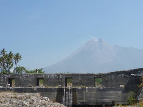
A volcanic eruption results in deposit of erupted materials (e.g., volcanic ash, pyroclastic flow), which potentially cause increases in frequency and magnitude of debris flow and/or flash flood (i.e., lahar). Coverage of the erupted materials on hillslopes typically reduces infiltration of rainfall and decays vegetation. The eruption can severely change the rainfall-runoff processes in the volcano Therefore, the change of rainfall-runoff processes is essential for prediction of debris flow after the eruption. On the other hand, infiltration property of the hillslopes covered by the volcanic materials will change temporally due to physical factors and chemical reactions. To understand temporal change of infiltration property after eruption and develop a hydrological model, we have conducted field observations and field experiments in Sakurajima volcano and Mt. Merapi in central Java, Indonesia.
Click here for references
- 平川泰之,岡野和行,植野利康,里深好文,堤大三,宮田秀介(2019):噴火後20年を経過した雲仙普賢岳の火砕流堆積斜面における土石流発生を助長する地形・地質的条件,砂防学会誌,72(1),21-31.
- Gonda, Y., Miyata, S., Fujita, M., Legono, D., Tsutsumi, D. (2019): Temporal Changes in Runoff Characteristics of Lahars after the 1984 Eruption of Mt. Merapi, Indonesia, Journal of Disaster Research, 14(1), 61-68.
- 平川泰之,岡野和行,植野利康,堤大三,宮田秀介,里深好文(2018):雲仙岳の噴火後20年を経過した火砕流堆積斜面における土石流発生場の地形・地質特性,砂防学会誌,71(3),12-20.
- Gonda, Y., Miyata, S., Fujita, M., Legono, D., Tsutsumi, D. (2018): Temporal changes of rainfall-runoff relationship after the 1984 eruption of Mt. Merapi, Indonesia, Proceedings of the 21th IAHR-APD Congress, 1277-1283.
- Masaoka, N., Kosugi, K., Katsuyama, M., Mizuyama, T., Miyata, S., Tsutsumi, D. (2014): Effects of bedrock groundwater and geological structure on hydrological processes in mountainous watersheds, Symposium Proceedings of INTERPRAEVENT2014 in the Pacific Rim, P-25, 1-7.
- 宮田秀介,藤田正治(2013):レーダ雨量を用いた流出シミュレーションと桜島における土石流発生渓流への適用,京都大学防災研究所年報,56(B),457-464.
Flash flood in alpine watersheds
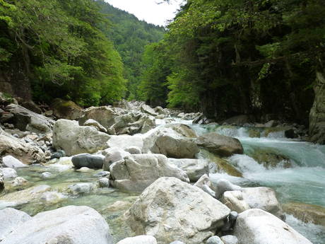
Flash flood is a phenomena in which river water level increases very rapidly; for instance, increases in water level of several ten to hundred cm within a few minutes. Disasters due to flash flood are sometimes reported in alpine watersheds. Because flash flood can reach downstream where little precipitation is observed, people in and along the alpine stream cannot keep sufficient lead time for evacuation. We observe rainfall and runoff in Kanakido River and perform a numerical experiment to understand trigger and behavior of flash flood and propose a risk index of flash flood.
Click here for references
- Hairani, A., Rahardjo, A.P., Legono, D., Istiarto, Miyata, S. (2018): Spatially distributed evaluation of initiation of mass erosion, Proceedings of the 21th IAHR-APD Congress, 1139-1144.
- 宮田秀介,藤田正治,堤大三,市田児太朗(2014):神通川水系金木戸川における水文観測-フラッシュフラッド現象の解明を目指して-,砂防学会誌,66(5),92-95.
- Miyata, S., Fujita, M., Teratani, T., Tsujimoto, H. (2014): Flash flood due to local and intensive rainfall in an alpine catchment, Symposium Proceedings of INTERPRAEVENT2014 in the Pacific Rim, O-33, 1-8.
Application of TDR to bedload monitoring
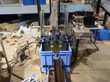
Bedload in steep mountainous streams is dependent on sediment supply as well as stream discharge. Monitoring of bedload in the field is critical for watershed management and mitigation of river and sediment disasters. Although a lot of bedload monitoring methods have been previously proposed, each of the methods has advantages and disadvantages. Thus, to understand sediment transport processes in steep watersheds, an appropriate measurement technique should be determined at each gauging station. Bedload can be estimated by temporal changes of sediment volume along river reaches or in pools such as retention basin. We have developed a new method for measurement of sediment volume in a retention basin with high resolutions in space and time by applying TDR (Time Domain Reflectometry).
Click here for references
- 宮田秀介,野中理伸,靏本孝也,上小牧和貴,岩男忠明,藤田正治(2021):TDRセンサーを用いた土石流の間隙流体土砂濃度の現地観測,砂防学会誌,74(4),42-47.
- Miyata, S., Mizugaki, S., Naito, S., Fujita, M. (2020): Application of time domain reflectometry to high suspended sediment concentration measurements: laboratory validation and preliminary field observations in a steep mountain stream, Journal of Hydrology, 585, Article 124747.
- 内藤秀弥,宮田秀介,岸本昌之,服部浩二,石塚忠範,永田葉子,小菅尉多,藤田正治(2018):TDRによる土砂濃度計測を用いた山地河川での浮遊砂鉛直分布の観測,砂防学会誌,71(4),3-12.
- Miyata, S., Fujita, M. (2018): Laboratory based continuous bedload monitoring in a model retention basin: Application of time domain reflectometry, Earth Surface Processes and Landforms, 43(9), 2022-2030.
- 宮田秀介,藤田正治(2015):TDR(時間領域反射測定法)を利用した堆積土砂面位および空隙率測定,砂防学会誌,68(1),32-38.
Sediment flushing experiment
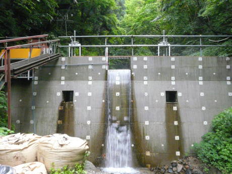
Sediment transport and erosion by river flow result in river bed change. Various methods of measuring sediment transport and river bed elevation have been proposed. Recently, new methods associated with technological progress have also been developed. Although these measurement methods with different approaches can extend potential monitoring sites, limitations of each method should understood. We collaborate with researchers from various universities (e.g., The University of Tokyo, Niigata University and Shizuoka University) and preform sediment flushing experiments to compare different measurement methods of bedload and river bed change in a step-pool stream. The measurement results by different approaches are employed to evince limitations of the methods and improve monitoring techniques.
Click here for references
- 長谷川祐治,宮田秀介,今泉文寿,中谷加奈,堤 大三(2017):流砂の衝突回数を考慮したハイドロフォンデータによる解析手法の提案と現地への適用,土木学会論文集B1(水工学),73(4),I_523-I_528.
- Imaizumi, F., Gomi, T., Kobayashi, S., Negishi, J.N. (2009): Changes in bedload transport rate associated with episodic sediment supply in a Japanese headwater channel, CATENA, 77(3), 207-215.
- 木下篤彦,藤田正治,水山高久,澤田豊明(2006):砂防ダムからの排砂による溶存酸素濃度の低下とその予測,砂防学会誌,59(2),13-20.
- 木下篤彦,水山高久,藤田正治,澤田豊明,吉清守(2001):ヒル谷における人為的排砂のイワナへのインパクト, 河川技術論文集,7,363-368.
Large scale experiment of landslide dam overtopping and dam break
Landslide dam produced by a blockage due to a huge landslide or a debris flow has a risk triggering a devastating disaster after the overtopping and dam break. There are little experiments regarding the overtopping and dam break processes. We cooperate with Ritsumeikan University to conduct middle scale experiment on overtopping and dam break in the Hiru dani stream.
Click here for references
- Takayama, S., Miyata, S., Fujimoto, M., Satofuka, Y. (2001): Numerical simulation method for predicting a flood hydrograph due to progressive failure of a landslide dam, Landslide, 18,3655–3670.
- Takayama, S., Satofuka, Y., Fujimoto, M., Miyata, S. (2021): A field experimental study of a landslide dam outburst following progressive failure in the Ashiaraidani basin, Proceedings of 14th Congress INTERPRAEVENT2021, 294-302.
- 高山翔揮,星山博紀,宮田秀介,藤本将光,里深 好文(2019):進行性崩壊による天然ダム決壊過程に関する現地実験,土木学会論文集B1(水工学),75(2),I_847-I_852.
- 原田紹臣,赤澤史顕,速水智,柳崎剛,里深好文,藤本将光,堤大三,宮田秀介(2015):足洗谷流域ヒル谷における天然ダム決壊に関する現地実験,砂防学会誌,67(6),41-48.
- Akazawa, F., Ikeda, A., Hayami, S., Harada, N., Satofuka, Y., Miyata, S., Tsutsumi D. (2014): Numerical Simulation of Landslide Dam Deformation by Overtopping Flow, International Journal of Erosion Control Engineering, 7(3), 85-91.
