Outline
We have conducted various observations in the mountanious watershed including one of the active volcano "Mt. Yakedake", aiming for elucidateing sediment movement processes and mitigating sediment related disasters. The Hodaka Sedimentation Observatory is one of a few research facilities which have carried out continuous monitoring for sediemnt transport in a mountanious watershed.
Since the observatory was established, we have carried out monitoring of water discharge, sediment transport, and sediment production in the watershed continuously. Recently, we also conduct, monitoring of a distributing rainfall typically observed in mountanious area, observation of sediment production from weathered bedrock on a bare slope, experiment for developing an effective sediment flushing from a dam reservoir, and monitoring of debris flow transport. Furthermore, cooperating with the Kamitakara Observatory, Research Center for Earthquake Hazards, we investigate countermeasure against various hazards resulting in consequence of anticipated erupsion of Mt. Yakedake.
The Hodaka Sedimentation Observatory aims for a field station that bears overall "mountain researches" for various natural phenomena in the mountanious region.
| Year | Issues |
|---|---|
| 1965 | Sediment control research division was established in Disaster Prevention Research Institute. The observatory was also established. |
| 1967 | The observatory belonged to the Disaster Prevention Research Institute |
| 1996 | The observatory belonged to the Research Center for Field Observation, Disaster Prevention Research Institute |
| 2005 | The observatory belonged to the Research Center for Fluvial and Coastal Disasters, Disaster Prevention Research Institute |
| 2024 | The observatory belonged to the Research Center for Volcano Hazards Mitigation, Disaster Prevention Research Institute |
Facilities
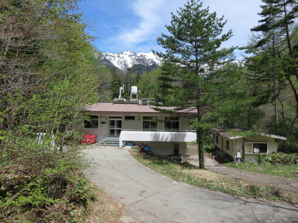
The observatory is located 4 km north from the sumit of Mt. Yakedake, which rises on the border between Gifu and Nagano Prefectures. The location is almost center of the Hida Mountains of 3,000 m range, such as Hodaka Mountains and Mt. Kasa.
Hodaka Sedimentation Observatory is a member of the Field Research Section for Fluvial and Coastal Hazards, together with Shionomisaki Wind Effect Laboratory (Kushimoto, Wakayama), Shirahama Oceanographic Observatory (Shirahama, Wakayama), Ogata Wave Observatory (Jyoetsu, Niigata), on the frontiers of the field observation for natural hazards.
| Facilities | |
|---|---|
| Observatory | Area: 7,779㎡ Buildings:main building、laboratory building、two depot buildings |
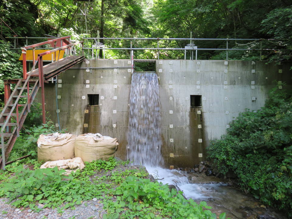
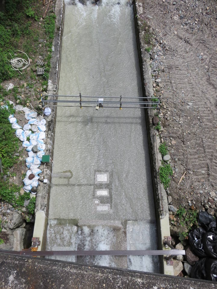
| Observation watersheds | Hiru dani: 0.85 k㎡, Ashi-arai dani: 6.5 k㎡ , The Takahara River: 526 k㎡ |
| Shared facilities | Hiru dani check dam, Ashi-arai dani observation flume |